Modeling tropical montane forest biomass, productivity and canopy traits with multispectral remote sensing data
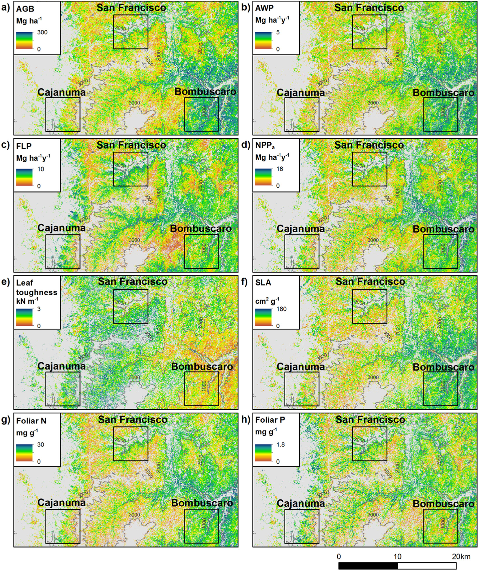
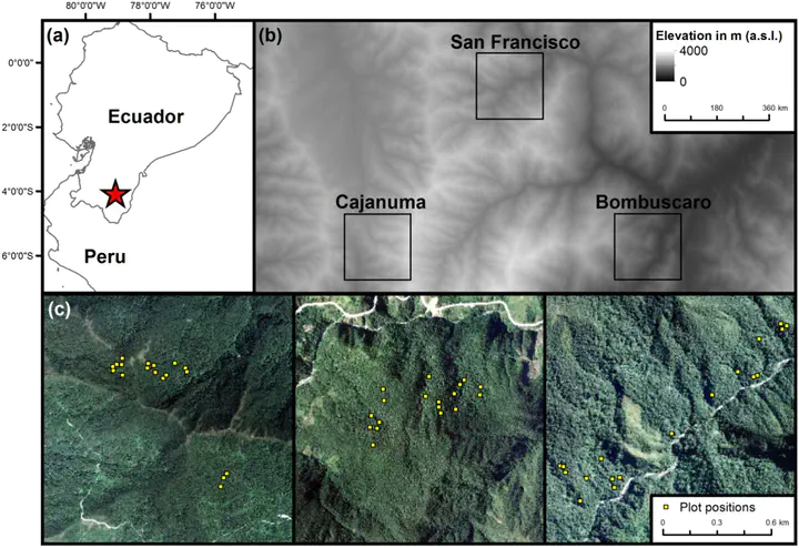 Study area
Abstract
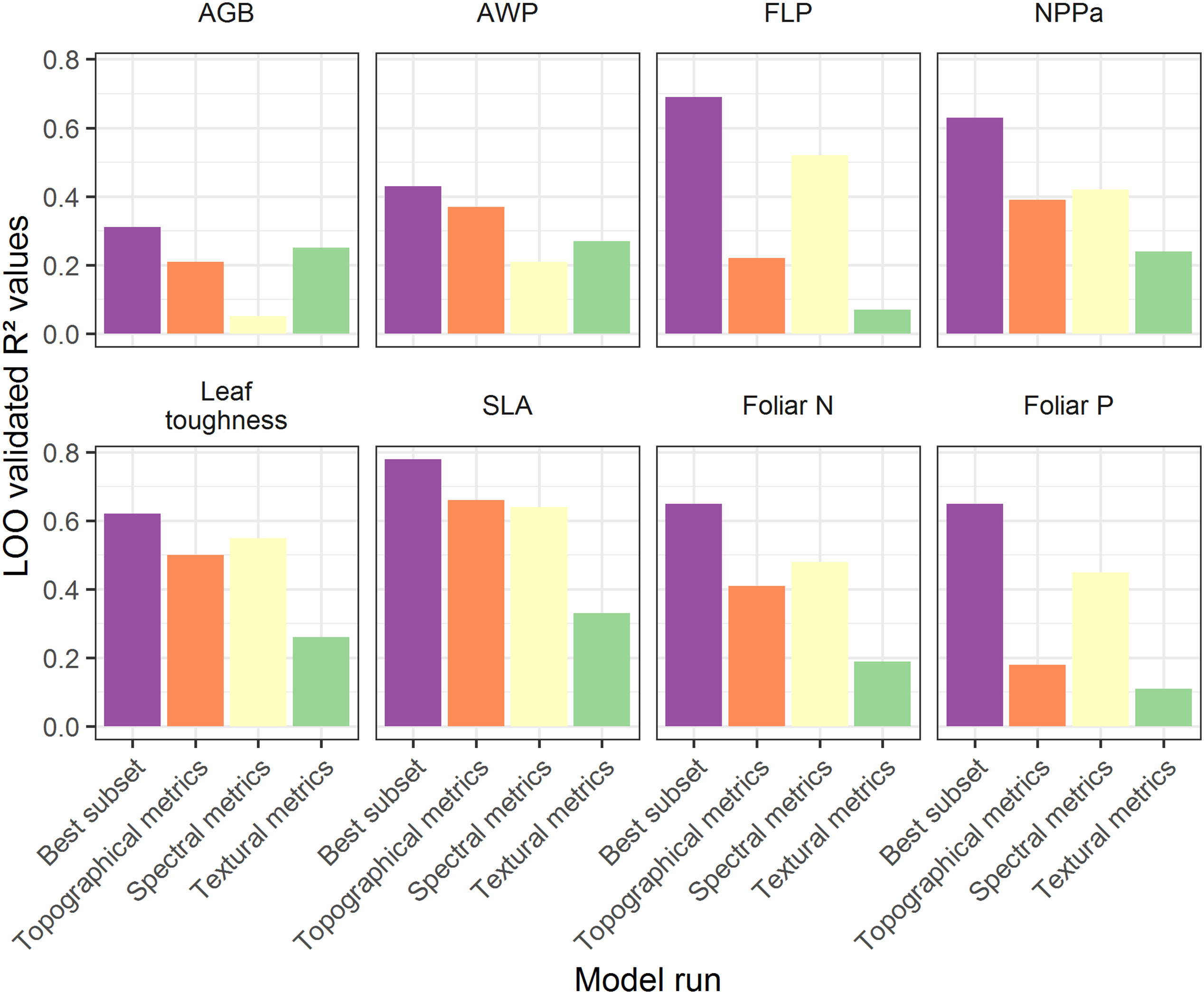
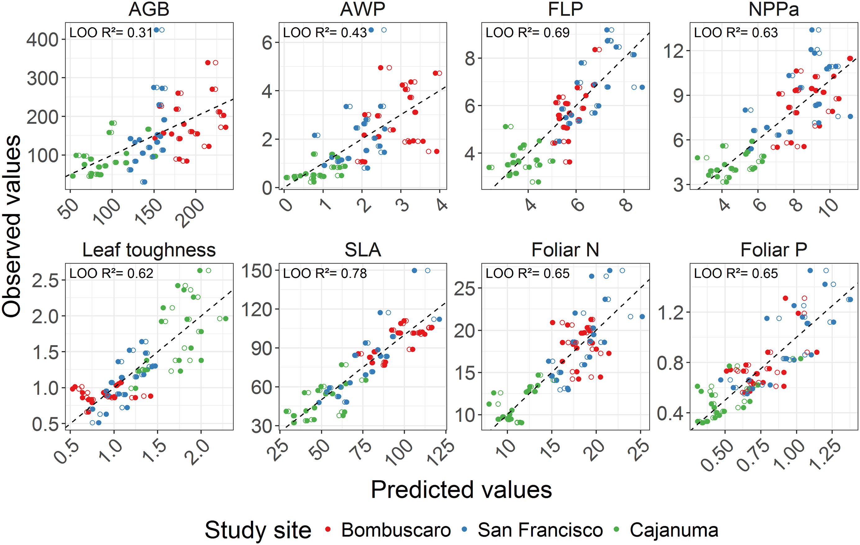
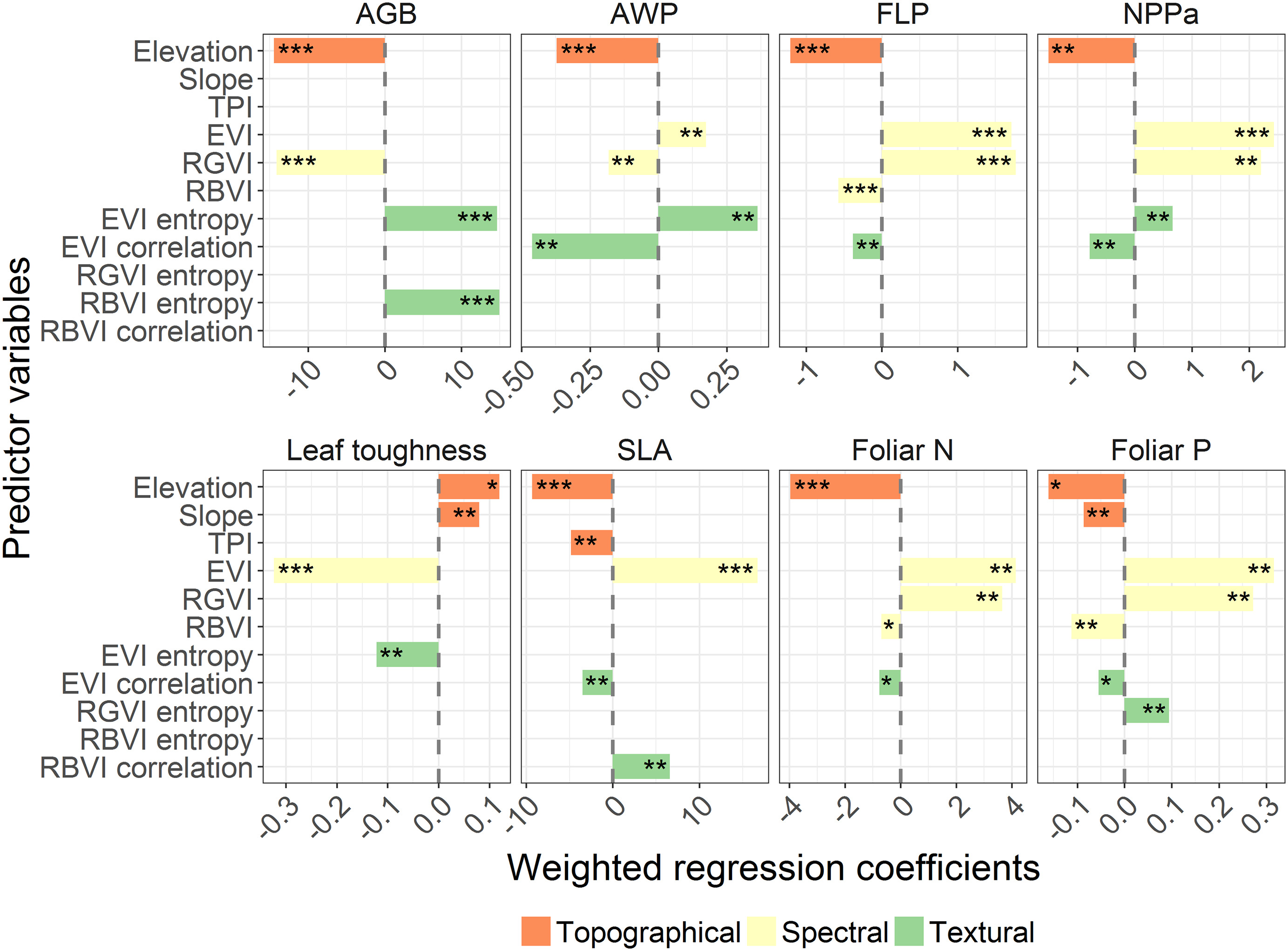
Tropical montane forests, particularly Andean rainforest, are important ecosystems for regional carbon and water cycles as well as for biological diversity and speciation. Owing to their remoteness, however, ecological key-processes are less understood as in the tropical lowlands. Remote sensing allows modeling of variables related to spatial patterns of carbon stocks and fluxes (e.g., biomass) and ecosystem functioning (e.g., functional leaf traits). However, at a landscape scale most studies conducted so far are based on airborne remote sensing data which is often available only locally and for one time-point. In contrast, multispectral satellites at moderate spectral and spatial resolutions are able to provide spatially continuous and repeated observations. Here, we investigated the effectiveness of Landsat-8 imagery in modeling tropical montane forest biomass, its productivity and selected canopy traits. Topographical, spectral and textural metrics were derived as predictors. To train and validate the models, in-situ data was sampled in 54 permanent plots in forests of southern Ecuador distributed within three study sites at 1000 m, 2000 m and 3000 m a.s.l. We used partial least squares regressions to model and map all response variables. Along the whole elevation gradient biomass and productivity models explained 31%, 43%, 69% and 63% of variance in aboveground biomass, annual wood production, fine litter production and aboveground net primary production, respectively. Regression models of canopy traits measured as community weighted means explained 62%, 78%, 65% and 65% of variance in leaf toughness, specific leaf area, foliar N concentration, and foliar P concentration, respectively. Models at single study sites hardly explained variation in aboveground biomass and the annual wood production indicating that these measures are mainly determined by the change of forest types along with elevation. In contrast, the models of fine litter production and canopy traits explained between 8%–85% in variation depending on the study site. We found spectral metrics, in particular a vegetation index using the red and the green band to provide complementary information to topographical metrics. The model performances for estimating leaf toughness, biochemical canopy traits and related fine litter production all improved when adding spectral information. Our findings therefore revealed that differences in fine litter production and canopy traits in our study area are driven by local changes in vegetation edaphically induced by topography. We conclude that Landsat-derived metrics are useful in modeling fine litter production and biochemical canopy traits, in a topographically and ecologically complex tropical montane forest.