CABO
Project: Plant spectral diversity as an integrator and predictor of community-level taxonomic and functional diversity (Canadian Airborne Biodiversity Observatory, CABO)
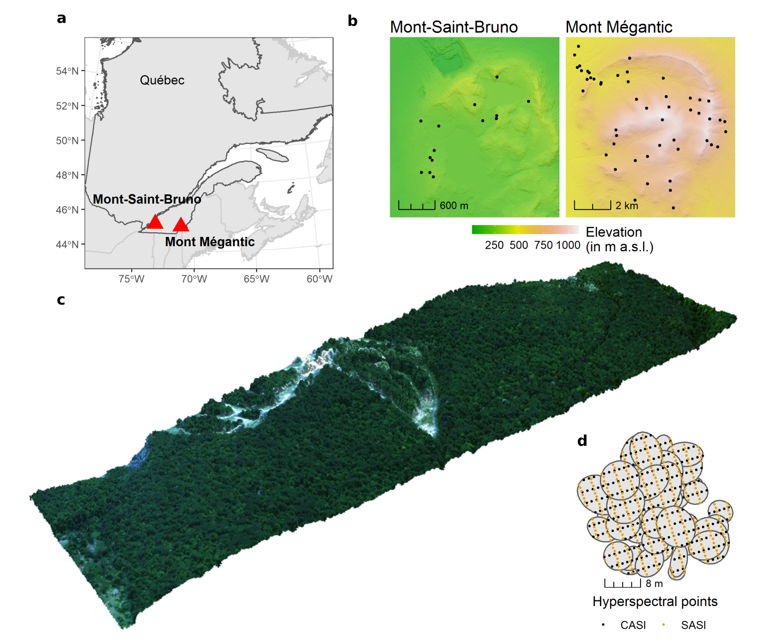
Surrogates from remote sensing can help to model and predict plant communities and their diversity across space. However, finding suitable indicators is still challenging. Within the CABO project, we are testing the robustness of spectral diversity metrics derived from hyperspectral data across different spatial and spectral scales.
In a first study (which will soon be published in Remote Sensing of Environment), we found that hyperspectral remote sensing is strongly linked to aboveground tree carbon content via the composition of trees but not via tree diversity; mostly driven by a turnover from deciduous to coniferous species along the elevational gradient at Parc national du Mont-Mégantic. It was also very exciting to use a new hyperspectral data format: the directly georeferenced hyperspectral point cloud (DHPC). That point data format is not affected by resampling errors often present in raster data formats (look here for the details: Inamdar et al. 2022 ). After many studies of using machine learning models, I found it super refreshing to try out a more hypothesis driven analysis like partial-least squares path modeling.